
In early May, as federal regulators were finalizing East Coast vessel speed restrictions to try to protect North Atlantic right whales, some of the marine industry’s leaders gathered on Capitol Hill to explain — again — that today’s technology can be a much less disruptive solution. “There are groups intentionally selling misinformation,” says John DePersenaire, director of government affairs and sustainability for Viking Yacht Co. in New Gretna, N.J. “They’re saying technology doesn’t play a role, that there’s nothing right now with regard to whales, and even if it is going to work, it’s five to 10 years away.”
That’s simply not true, according to DePersenaire and several other members of the Whale and Vessel Safety Task Force formed more than a year ago to offer alternatives to the government’s speed-restriction plan, which the head of the National Marine Manufacturers Association calls an “existential threat” to the industry. The WAVS Task Force, which originally focused only on creating tools, has also had to become more active in advocacy because of the false information circulating around Washington, D.C., DePersenaire says.
Advocacy ramped up in February, after U.S. Rep. Frank Pallone Jr., D-N.J., issued a press release stating that the technology necessary to avoid whales is still in the early stages of development. “It was like no technology exists,” DePersenaire says. “I called him up and said, ‘I saw your letter, and it’s wrong. I’d love to have the opportunity to explain so you can speak accurately on this issue.’ We ended up doing an hourlong virtual briefing with him and a few other companies involved in this work. He was like, ‘Oh, this is really helpful.’ So we knew that we were going to have to be more active.”
Officials from the National Oceanic and Atmospheric Administration got a
similar education during a visit to the Discover Boating Miami International Boat Show in February, says Shaun Ruge, director of marine business development at Garmin and a WAVS Task Force member. “From what we’ve heard, that was a pretty eye-opening experience for them,” he says.
After that, in March, NOAA sponsored a workshop with various stakeholders, including marine technology companies. Ruge says those discussions were great and have led to further conversations. “Some of the actions we’ve seen since then suggest they’re interested in working with the task force to try and find better solutions,” he says. “We don’t know if the discussions that are happening will have any implications for the rule. All we can say is that Garmin is committed to facilitating integration where there’s a need. And that’s not just Garmin. That’s all the companies in the WAVS Task Force.”
The Tech Exists Now
DePersenaire’s role as moderator of the Capitol Hill panel in May was to explain that collision-avoidance technology, in general, is far from a new concept in boating. The intent has long been to help boaters avoid colliding with anything. “All the things we’ve been working on for decades is building upon our ability to not hit North Atlantic right whales,” he says. “It’s always a space we’ve been working in, but we’ve accelerated some of the work specific to right whales.”
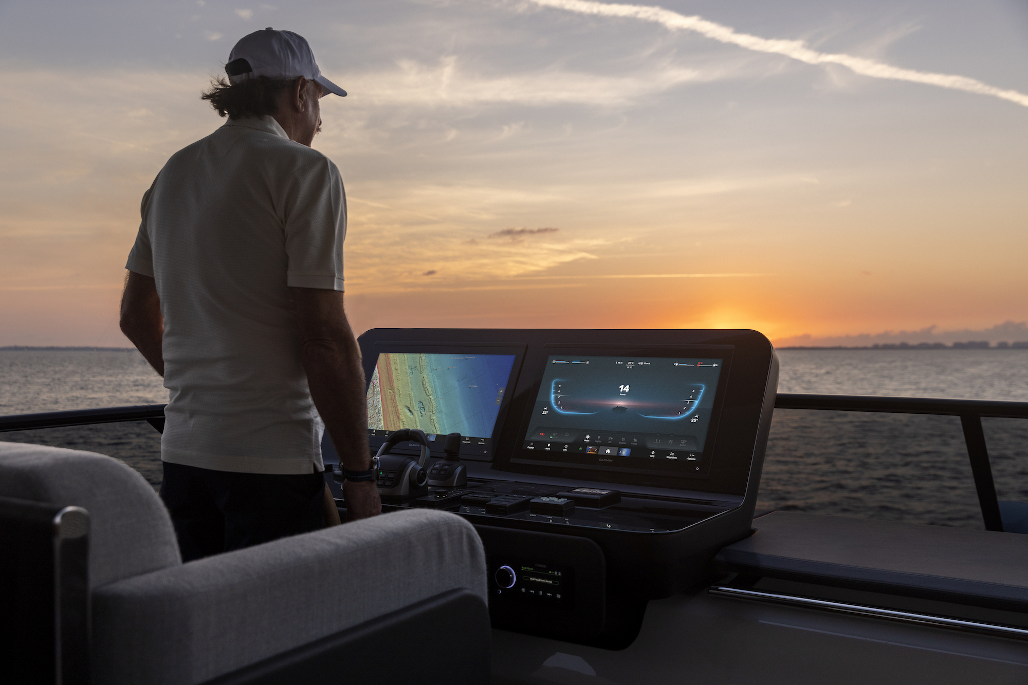
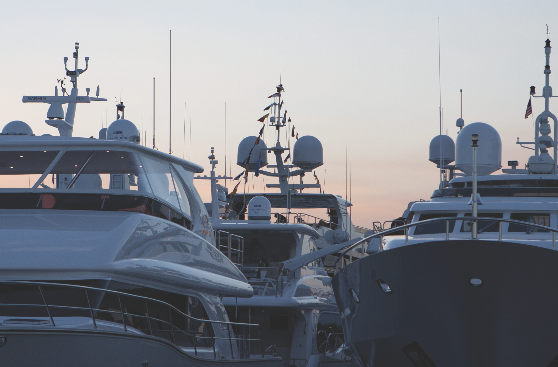
WAVS Task Force participants include leading experts from Fathom Science, Atlantic Marine Electronics, Navico Group, SEA.AI, FarSounder and the National Marine Electronics Association. The companies already have technology that can spot objects the size of whales, and sometimes whales in particular, above and below the water, as well as technology that can push that information out to boaters in multiple ways.
 COURTESY GARMIN
Some of that technology is already quite advanced, DePersenaire says. AI-based systems can detect a whale’s breath near the surface based on temperature and moisture-content changes. With underwater sonar data, analytics can parse which whale species is being vocal, as well as how far away the whale is.
Regulators until recently were unaware of what exists and that companies that are often fierce competitors weren’t collaborating on this problem. “It’s pretty clear that all the parts of the solution are there. The puzzle pieces just have to be put together,” says FarSounder CEO Matt Zimmerman. “To me, it seems like we have a huge communication need and a huge information need. And I know it’s Washington, D.C., but if you can remove the politics from this, I think it can be solved relatively easily.”
The team at Fathom, he says, has used machine learning to train a model on historical information about whale locations, and has correlated that information to various environmental conditions. “They believe they have a model which does a pretty good job of saying, ‘Based on these environmental conditions, here’s where you should expect to see whales,’ ” Zimmerman says. “That’s not an exact coordinate, but for an area, there’s a probability of finding whales, the general areas to expect them.”
That model can be combined with above- and below-surface detections from boats in the vicinity, he says. “There are sensors today that can detect the presence of whales and localize their location on a per-vessel basis,” Zimmerman says. “FarSounder forward-looking sonars, there’s SEA.AI above the water — those types of technologies can tell the vessel, ‘Here’s the thing in this location that we think is something you don’t want to hit.’ ”
Deploying the Tech at Scale
The next challenge is pushing the whale-location information out in a wide-reaching way. Regulators look to vessel-speed restrictions because they can be applied to boats across the board. That’s not usually true with technology. Newer and higher-end boats generally have more advanced tech than less-expensive and older boats. That’s why the task force is talking about using the Automatic Identification System, DePersenaire says. A discrepancy still exists with AIS — larger and higher-end vessels likely have systems with broadcast and receiver capabilities, while smaller and older boats usually have receive-only versions — but that is enough to make the idea work.
 GARY REICH
“Say a Viking is off the coast of New Jersey and detects a whale,” DePersenaire says. “We can move that information to a centralized aggregator and push it back out to the fleet through AIS or inReach so other boats can get the information. That’s how we can make that scalable. As long as a boat has basic communications on board, we can reach the majority of the fleet, even if they don’t have the most expensive equipment on their boat.”
Zimmerman says AIS already detects objects in addition to other vessels, such as bridges, lighthouses and electronic aids to navigation. The way to add whale-observation information is by building more shore-based AIS transmitters.
DePersenaire says that resources are already being sought to build an AIS transmit network along the coast, and that talks are in the works with the relevant government agencies for approvals. “We are in the discussions to make all of that happen,” he says. “The Coast Guard and NOAA are highly in support of that, and from what we understand, that is all moving forward now. The one part we need to figure out is the transmit side. People are working on that, too.”
None of this is years away, the task force members stress. It can be done today, as a better option than widespread speed restrictions. “The position that we’re trying to reinforce is that technology plays a role,” Ruge says. “The technology we’re talking about is not five years down the road; it’s here now. The barriers to getting this all up and running are quite low.”
This article was originally published in the July 2024 issue.